Details
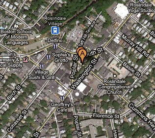
- Where: Meet at Adams Park in Roslindale Square.
- When: 9:30 in Adams Park or 10:00 am on Bellevue Hill
- Distance: about 18.3 miles.
- Pace: Relaxed, probably 6-10 MPH.
- Terrain: Rolling, with some bigger hills near the start
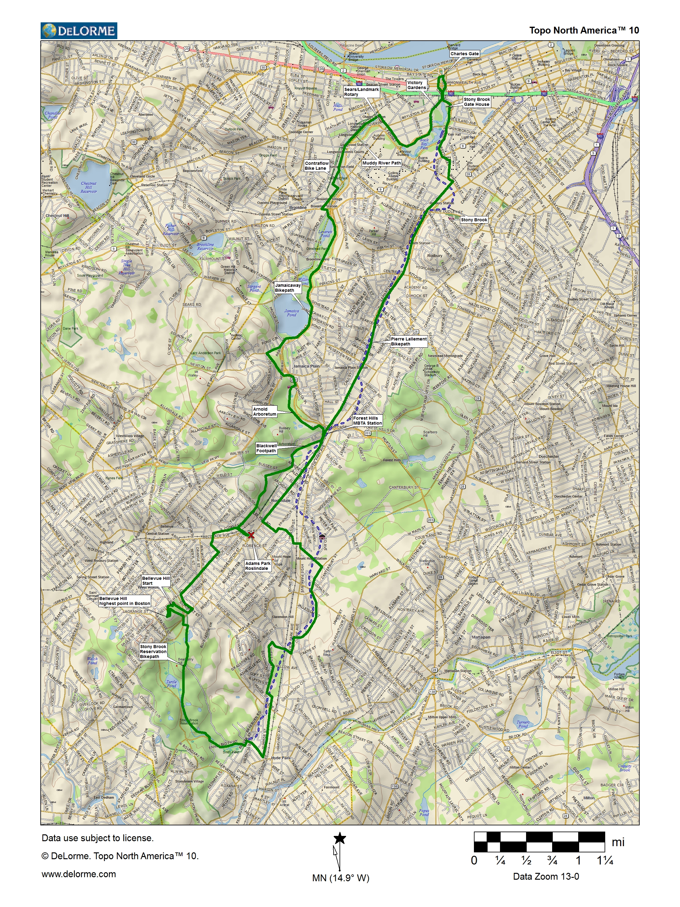
- Route: Route map and cue sheet
Cue Sheet
Map (4,496,293-byte JPEG)
Profile (112,438-byte JPEG) - Leader: Jessica Mink
Photos of the 2013, 2010, and2007 Rides
Getting To the Start
Adams Park in Roslindale Square, the center of a triangular rotary formed by the intersections of Washington, Poplar, Corinth, and South Streets. Cummins Highway, coming from the east, dead ends into the park, too. It is about one mile south of the Forest Hills Orange Line MBTA station.Bellevue Hill is above the highest point on Washington St., about a mile south of Roslindale Square (and a couple of hundred feet higher). The West Roxbury and Enneking Parkways intersect with Washington St. here.
By Bike
From the North: Take the Southwest Corridor or the Emerald Necklace paths or the Ornage Line to Forest Hills, then follow the Washington St. bike lanes to Roslindale Square or Bellevue Hill.From the East: Come through Franklin Park to Forest Hills and follow the Washington St. bike lanes, or take Cummins Highway from Mattapan.
From the South: Take Washington St. or Belgrade Ave. to Roslindale Square. For Bellevue Hill, take either Washington St. or the Enneking Parkway to the light, then turn left (or go straight from Ennieking) on the West Roxbury Parkway and take an immediate left onto the paved path.
From the West: Take Lagrange St. from Brookline to Centre St. in West Roxbury. Turn right, then take a right on Belgrade just before the rotary, and follow that to Roslindale Square. To get to the summit of Bellevue Hill, turn right off Centre onto Bellevue, go uphill until it ends, then turn left and stop at the gate on your right.
By Car
In Roslindale Square, there is free on-street parking and a large, free parking lot off Taft Hill Court, right off South St. There is on-street parking at the top of Bellevue Hill.From the North: Take the Riverway to the Jamaicaway to the Arborway and exit at Forest Hills. Turn right at the bottom of the ramp and proceed straight for about a mile. Washington St. becomes one-way the opposite way and you will be forced to bear right. You're there! Look for a parking space and meet us in the park.
From the West: Take Route 9 to the Hammond Pond Parkway. Take the second right at the first rotary onto Lagrange St. and follow it across South Brookline and West Roxbury to Washington St. Turn left up the hill and continue down it. The sixth light after the turn is Poplar. If you can't park on the left side of the street, bear left on South St. and continue to look for parking places. There is a big lot the next right after you bear left. You can also follow the West Roxbury Parkway, the third right at the first rotary, through three more rotaries, then left at the next light on Belgrade Ave., which leads straight to Roslindale Square. A right on Corinth St. and a left on Washington get you to Adams Park.
From the East: Follow Cummins Highway from Mattapan Square or American Legion Highway straight to Roslindale Square. Turn right and then bear left and park in any space. The lot is the next right after you bear left.
From the South: Take Washington St. all of the way or follow Hyde Park Ave. to Cummins Highway and take a left on that to the park.
Click for zoomable/panable map